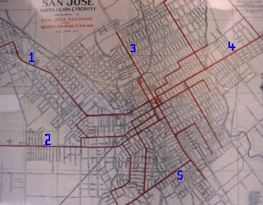
 The map on the left dates from the 1920s and shows the streetcard lines in San Jose at that time.
MORE PHOTOS OF SAN JOSE, CALIFORNIA
By the early 1900s, there were more than 30,000 streetcars in the United States, using approximately 15,000 miles of track. Electric streetcars, also called trolleys, ran on tracks and used a pole to draw power from an overhead wire. By 1917, U.S. streetcars were carrying more than 11 billion passengers a year.
Yet, only a few decades later these streetcars were virtually abandoned. People were buying cars and wanted to use them to get around town, and buses were more flexible in terms of routes. Gas companies, of course, encouraged both, at the expense of the streetcars.
Streetcars first appeared in San Jose in 1890. The trolley lines eventually ran from San Jose south to Los Gatos and north to Palo Alto. By 1933, regular service to the west side of the valley ceased. The last streetcar ran in San Jose in 1938. Blocks of houses and older buildings were torn down to make vast parking lots for people who wanted to drive their cars downtown.
The map on the left dates from the 1920s and shows the streetcard lines in San Jose at that time.
1. The Alameda line connected San Jose to Santa Clara
2. The San Carlos line (then called Steven Boulevard) eventually connected to the town of Saratoga via the Saratoga Avenue line and the Town of Los Gatos via the Bascom Avenue line (then called San Jose-Los Gatos Road)
3. The First Street line ran north-south through the center of downtown.
4. The Santa Clara line went into the east foothills and Alum Rock Park.
5. Willow Street connected to the First Street line and carried residents of Willow Glen to and from downtown San Jose.
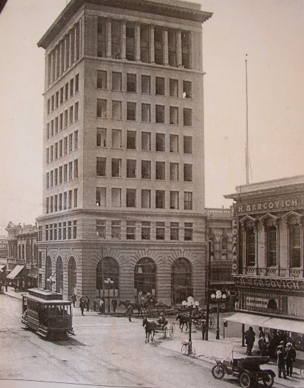
On the right is a photograph of the building that once stood at the southwest corner of Santa Clara and First Street. You can see three modes of transportation popular at that time: (1) streetcar; (2) automobile; and (3) horse and buggy. All that is missing is a bicycle, another cheap way to get around.
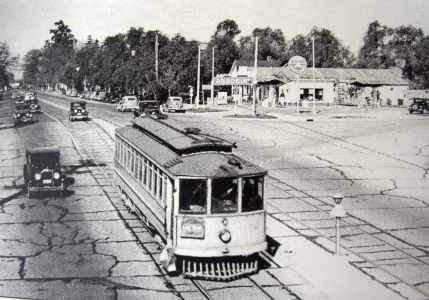
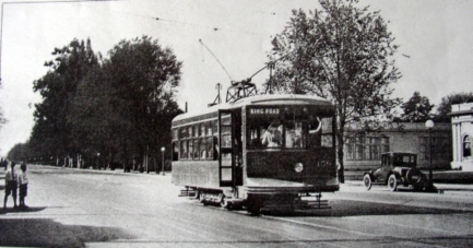
The photos above and on the right are streetcars that ran along The Alameda. The Alameda was always a broad street that allowed for trolleys, as well as cars and horse-drawn carriages. Bascom Avenue, Meridian Avenue and Saratoga Avenue were also wide for the same reason -- trolley lines ran down the middle.
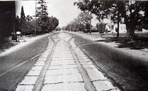
The photo on the left shows the tracks that once ran down Meridian from San Carlos into Willow Glen. The tracks were removed and sold for scrap metal, but the traces remained for many years. They now lie under several layers of asphalt. The house on the right behind the tree can still be seen on the west side of Meridian, north of Willow Street.
San Jose 1975-2006