 |
 |
|
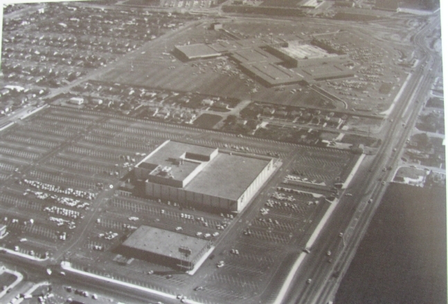
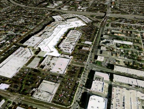
On the left an aerial view of Valley Fair in 1958 seen from approximately Winchester and Stevens Creek, looking east. Old-timers will remember the larger building in the foreground as The Emporium. In the background, an entire separate building, was Macy's. The strip in between? Residences! Nobody dreamed of parking a car at Macy's and *walking* to The Emporium! To the south, it is still orchard -- the old Town & Country Village had not been built yet. You can see Highway 17 (aka 880) in the upper corner. On the right is a GoogleEarth-generated aerial of the area, showing the mall, three parking structures, and Santana Row across the street on the south. On the upper edge you can see the interchange of Steven Creek/San Carlos and Highway 17. This comparison works pretty well, but other comparisons I've tried just don't. The Google-Earth version is an extrapolation, not a real photograph so you can't quite get the angle. The buildings are flattened. Also, you can't get really close aerials. This will do for now, until I can actually get up in an airplane. One more GoogleEarth-generated shot: |
||
 |
 |
|
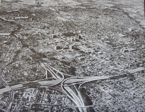
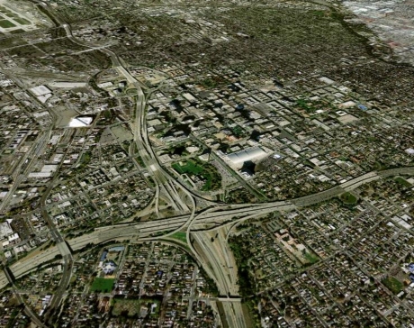
This one was pretty successful. It's of the intersection of Highway 280 and Highway 87, looking northeast across downtown San Jose. The photo on the left was taken in the early 1970s, when 280 was newly built, but 87 stops at about Julian Street. The angled effect does not quite work, but the overall effect is interesting.
|
||
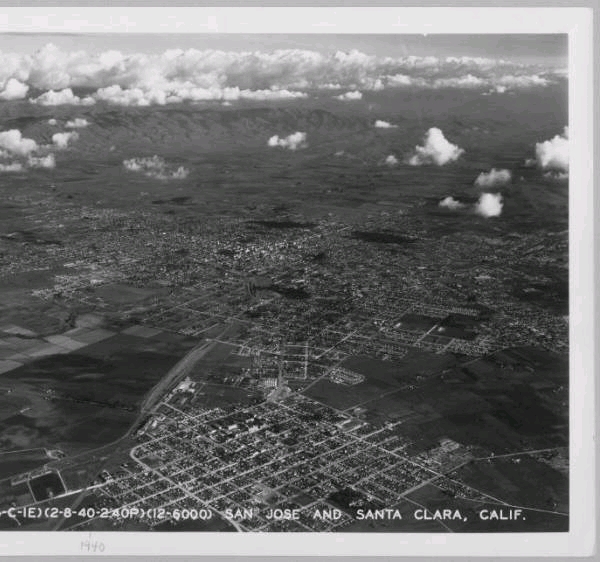
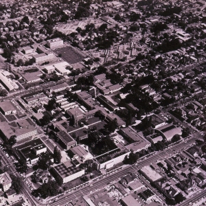
| Below are examples of aerial photos I hope to someday take for comparison. I tried getting GoogleEarth-generated shots and they just don't look good at all. The photo on the left is San Jose take looking southeast from Santa Clara in 1940. The one on the right is San Jose State University in 1959. | ||
 |
 |
|
| MODERN PHOTOS OF DOWNTOWN SAN JOSE -- 2008 and 2016 | ||
| I don't travel by air a lot but when I do, I try to get a window seat on the right side of the plane on the return flight. All photos below are looking eastward across downtown San Jose from about Highway 87. | ||
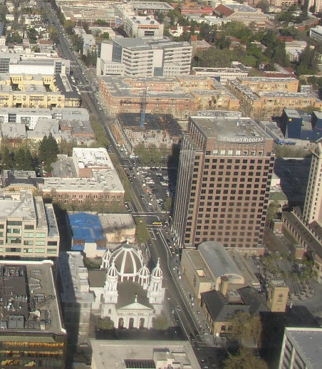 |
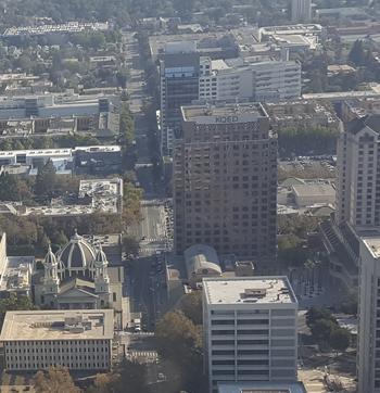
(2008) San Fernando -- St. Joseph's Cathedral, the Knight-Ridder building, with Martin Luther King library and San Jose State University in the background. (2016) San Fernando -- slightly different angle, but you can clearly see St. Joseph's Cathedral and the Knight-Ridder building. |
 |
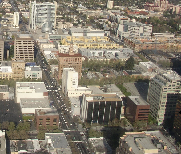 |
(2008) Looking eastward on Santa Clara Street, with the Bank of America Building near the center, City Hall beyond it. (2016) A different angle. You can see a lot of development in the foreground. |
 |
|
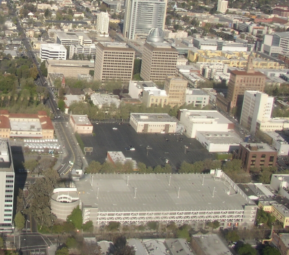
St. James with the Post Office on the far left, the twin towers on Second Street. The Bank of America Building is on the far right. The large black are is the Victory Parking Lot. | |
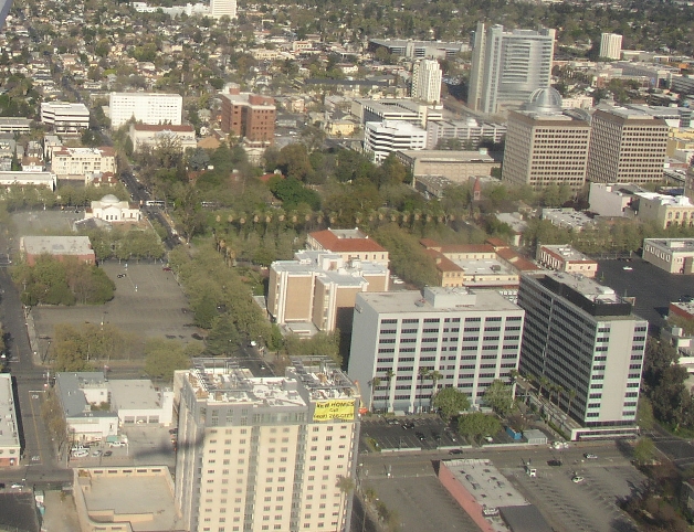 |
(2008) St. James Park, with the court house on this side of it, with its parking lot to the left. The Community Bank Building is closer still, on the right. You can see the City Hall dome and tower in the far right beyond the twin towers on Second Street. (2016) Lots of construction north of the court house and west of the Community Bank Building. They are also in the process of taking out the curve in Julian Street (lower left) and restore the downtown street grid. |
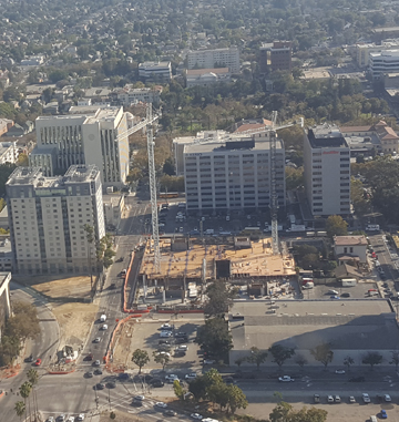 |
I am willing to go up in a plane to get some updated aerial photos. There are quite a few in the Historical Museum and various books that I could take a stab at getting a current version. Anyone have a plane or helicopter or know someone who'd be willing to take me up?
San Jose Then and Now The Box of Ghosts Project |
Many thanks to the San Jose Historical Museum and especially their archivist, Jim Reed, in locating the "THEN" photographs. |